The Best Beach Walks and Coastal Hikes in the World
Table of Contents
Walking Where Land Meets Water
A coastal hike shows you things a beach day cannot. From a clifftop, the water's depth and color gradients become visible, rock formations make geological sense, and you can see how cliff, cove and current fit together. And a beach reached on foot after a few hours of walking feels different from one reached by taxi.
The world's great coastal walks range from short paved strolls to multi-day wilderness routes that need fitness, permits and tide tables. This guide covers both, organized by region, with distances and access rules taken from the agencies that manage each trail.
The Walks Compared
| Walk | Where | Distance | Typical time | Permits and bookings |
|---|---|---|---|---|
| Bondi to Coogee Coastal Walk | Sydney, Australia | About 6 km | About 2 hours | None |
| Sentiero degli Dei (Path of the Gods) | Amalfi Coast, Italy | About 7.8 km | 3 to 4 hours one way | None |
| Dragon's Back | Hong Kong | About 8.5 km | Half a day | None |
| Kalalau Trail | Na Pali Coast, Kauai | 11 miles (about 18 km) | Overnight in full | Ha'ena State Park entry and parking reservation; camping permit to go past Hanakapi'ai |
| Lost Coast Trail | California | About 25 miles (40 km) | 3 to 4 days | BLM overnight permit via recreation.gov; bear-resistant canister required |
| Great Ocean Walk | Victoria, Australia | Over 100 km | About 8 days | Hike-in campsites must be booked (the booking is your permit) |
| Cape to Cape Track | Western Australia | 130 km | 5 to 7 days | None stated |
| Camí de Cavalls | Menorca, Spain | About 185 km | 7 to 10 days | None stated |
| Fishermen's Trail (Rota Vicentina) | Southwest Portugal | 226.5 km in 13 stages | About 13 days | None; walking only, no trail running |
| South West Coast Path | England | 630 miles (1,014 km) | 7 to 8 weeks in full | None |
Europe
The Fishermen's Trail, Southwest Portugal
The Rota Vicentina's Fishermen's Trail follows fishermen's paths along cliff tops, through dunes and down to beaches on Portugal's southwest coast. According to Rota Vicentina, it runs 226.5 km in 13 one-day stages (none longer than 22.5 km) through the Southwest Alentejo and Vicentine Coast Natural Park, so the coast is largely undeveloped.
It is harder than it looks on a map. Rota Vicentina rates it "somewhat difficult", with 60 to 70 percent of the route on sand, and says it is not recommended for people with vertigo or a fear of heights. It is walking only: no vehicles, and trail running is not allowed. Accommodation is in guesthouses in the villages along the route; book ahead in summer. The stage from Zambujeira do Mar to Odeceixe is a favorite, with beaches reachable only on foot.
Sentiero degli Dei (Path of the Gods), Amalfi Coast, Italy
A trail of about 7.8 km from Bomerano (part of Agerola) to Nocelle (above Positano), high on the cliffs with the Amalfi Coast spread out below: Positano, the Li Galli islands and Capri on the horizon. Allow roughly three to four hours one way. From Nocelle you can take a local bus or walk down a long stairway to Positano, which is hard on the knees.
Start from Bomerano (bus from Amalfi) and walk toward Positano so the best views are ahead of you. Start early to avoid the midday heat and the crowds. Bring water and sun protection; much of the trail has little shade.
South West Coast Path, England
At 630 miles (1,014 km), the South West Coast Path is England's longest National Trail, running from Minehead in Somerset around Devon and Cornwall to Poole Harbour in Dorset. Walking all of it takes most people around seven to eight weeks, so most walkers pick sections. Standouts include the Jurassic Coast between Lulworth Cove and Durdle Door (Dorset), the clifftops between Boscastle and Tintagel (Cornwall), and the beaches and headlands around St Ives and Porthcurno in far west Cornwall.
The path passes dozens of beaches, from wide surfing sands to small coves reachable only on foot. The Cornish sections are the most dramatic, with high cliffs and old tin-mine engine houses on the cliff edges. The weather is changeable all year; carry waterproof layers and wear sturdy footwear whatever the forecast.
Cami de Cavalls, Menorca, Spain
The roughly 185 km coastal path circling Menorca links dozens of beaches and is some of the best coastal walking in the Mediterranean. The south-coast section between Cala Galdana and Cala Macarella is the highlight: clifftop walking with turquoise coves below and paths down to beaches for a swim. The full circuit takes about 7 to 10 days, and individual sections work as day hikes.
Australia
The Great Ocean Walk, Victoria
The Great Ocean Walk runs for more than 100 km from Apollo Bay to the Twelve Apostles and typically takes eight days in full. It passes through forest, along cliff tops and down to beaches with offshore rock stacks. Arriving at the Twelve Apostles on foot is a satisfying way to see one of Australia's most famous landmarks.
The hike-in campsites must be booked before you arrive; the land manager says the booking acts as your permit to camp. Shorter overnight sections and day walks are also possible. Check tides, weather and track conditions before setting out, because some beach sections depend on the tide and the weather can change quickly. Kangaroos and koalas are common along the route.
Bondi to Coogee Coastal Walk, Sydney
The most accessible coastal walk in Australia: about 6 km from Bondi Beach to Coogee Beach along the sandstone cliffs of Sydney's eastern suburbs. It takes around two hours at a relaxed pace and passes Tamarama (a small, steep beach popular with surfers), Bronte (with a tidal pool) and Clovelly (a narrow inlet with calm water). Waverley Cemetery sits on the cliffs between Bronte and Clovelly.
The path is paved or boardwalk for most of its length and suits anyone of reasonable fitness, but it includes many stairs, so it is not stroller-friendly throughout. You can swim at the beaches along the way; check the flags and swim between them. Go early in the morning or late in the afternoon for softer light and fewer people.
Cape to Cape Track, Western Australia
According to Trails WA, the Cape to Cape Track runs 130 km along the Leeuwin-Naturaliste Ridge between the lighthouses at Cape Naturaliste and Cape Leeuwin and takes five to seven days end to end. It passes forest, limestone cliffs and quiet beaches; highlights include the surf beaches at Yallingup and Smiths Beach, the granite of Sugarloaf Rock, and the wild final stretch to the Cape Leeuwin lighthouse. Several shorter day sections are possible.
The Margaret River wine region sits just inland, and guided walks with lodge accommodation are available for those who prefer not to carry camping gear.
Americas
Lost Coast Trail, California
The Lost Coast is the longest stretch of undeveloped coastline in California, where Highway 1 turns inland because the terrain was too rugged for a road. The main trail runs about 25 miles (40 km) from Mattole Beach to Black Sands Beach near Shelter Cove, mostly along the beach, and includes sections that are impassable at high tide.
The walking is hard: soft sand, creek crossings and boulder sections. Overnight trips need a permit from the Bureau of Land Management, reserved through recreation.gov (numbers are limited in the busy season), and bear-resistant food canisters are required. Most people take three to four days. There are no services; carry all your food and treat stream water.
Kalalau Trail, Na Pali Coast, Kauai, Hawaii
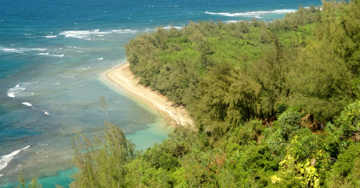
An 11-mile (about 18 km) trail along the Na Pali Coast, with fluted green cliffs rising as high as about 4,000 feet. The trail crosses five valleys and ends at Kalalau Beach, backed by a valley that was home to Hawaiian communities for centuries.
The full hike is strenuous and exposed, with narrow sections above steep drops. Access is tightly controlled: according to the Hawaii Division of State Parks, day hikers may go only as far as Hanakapi'ai Valley (2 miles in), with an advance entry and parking reservation for Ha'ena State Park; anyone going beyond Hanakapi'ai must hold a camping permit, released 90 days in advance. The Hanakapi'ai Falls hike (about 4 miles each way to a 300-foot waterfall) is the most popular option for fit day hikers. Do not cross streams when they are rising after rain.
Asia
Dragon's Back, Hong Kong
A ridge walk of roughly 8.5 km on Hong Kong Island's southeastern corner that ends at Big Wave Bay beach. The ridge has wide views of the South China Sea, the island-scattered coastline and wooded hills, all within a city of more than seven million people. The final descent to Big Wave Bay, a popular surf and swimming beach with snack shops, takes about half an hour.
Tips for Coastal Hiking
Sun and Heat
Coastal trails are often exposed with little shade. Wear a wide-brimmed hat, use sunscreen and reapply every two hours, and carry more water than you think you need: at least two liters for a half-day in warm weather, and three to four liters a day on longer walks in heat.
Tides
Some coastal trails (the Lost Coast, beach sections of the Great Ocean Walk) have stretches that are impassable at high tide. Check tide tables before starting and plan your timing. Getting trapped by a rising tide on a stretch with no route to high ground is a real and potentially fatal hazard.
Footwear
Trail runners are often better than heavy boots for coastal walks: lighter, quicker to dry and adequate for most terrain. For rocky or steep sections, ankle support matters more. Sport sandals or water shoes help on beach sections and stream crossings.
Frequently Asked Questions
What is the best coastal hike in Europe?
It depends on what you want. Portugal's Fishermen's Trail runs 226.5 km in 13 stages through a protected natural park, but much of it is on sand. The Path of the Gods on the Amalfi Coast is short (about 7.8 km) with the most dramatic views. England's South West Coast Path, at 630 miles (1,014 km), is the longest and most varied.
Can beginners do coastal hikes?
Yes. Sydney's Bondi to Coogee walk (about 6 km, mostly paved, with stairs) suits nearly anyone. Day sections of the South West Coast Path, the Cami de Cavalls and the Cape to Cape Track are good starting points. The Fishermen's Trail is harder than it looks because of the sand, and the Lost Coast and the full Kalalau Trail are for experienced hikers.
What should you bring on a coastal hike?
A wide-brimmed hat, sunscreen (reapply every two hours), plenty of water (at least two liters for a half-day in warm weather), trail runners or light hiking shoes, sandals or water shoes for beach sections, and wind and rain layers. For multi-day hikes, add a first-aid kit, blister treatment and a tide table for tidal sections.
Are tides dangerous on coastal hikes?
Yes, on trails with beach-level sections that become impassable at high tide, such as the Lost Coast Trail in California and beach sections of the Great Ocean Walk. Getting trapped by a rising tide with no route to high ground can be fatal. Check tide tables before starting.
Do I need a permit for the Lost Coast Trail or the Kalalau Trail?
Yes for overnight trips. The Lost Coast needs a Bureau of Land Management permit reserved through recreation.gov, and bear-resistant food canisters. On Kauai, day hikers can go only to Hanakapi'ai Valley with an advance Ha'ena State Park entry and parking reservation; going beyond Hanakapi'ai requires a camping permit, released 90 days ahead.
How long does the Bondi to Coogee walk take?
About two hours at a relaxed pace for the roughly 6 km route. It passes Tamarama, Bronte and Clovelly, with chances to swim at each. The path is mostly paved but has many stairs. Early morning or late afternoon starts are quieter.